Clear water between Levanto and Mesco Cape

Acqua cristallina in una caletta tra Levanto e Punta Mesco, lungo la costa delle Cinque Terre

Clear water between Levanto and Mesco Cape.
During a walk along the coast between Framura and Monterosso al Mare, I stopped when I noticed this small cove and the remarkably deep blue water below the trail. It was one of those views that immediately reminded me why the Ligurian coast has so many places worth seeing when you take the time to explore it on foot.
I took this photograph during a hike along the coast near Levanto, in Liguria, Italy. More precisely, I was following the trail towards Mesco Cape, the headland separating Levanto from Monterosso. It is a section of the route I have already photographed several times, and it continues to reveal different details whenever I walk through it.
This time it was not the wide panorama that made me stop. It was the color and clarity of the water below the trail. From above, I could clearly see the small beach and, just a short distance from the shore, a little boat anchored in the sea. Looking at it, I immediately thought how pleasant it would be to be there rather than standing on the trail, with the boat resting in front of the cove.
I wanted to capture this detail with my camera because it seemed to represent one of the things I enjoy most about the Ligurian coastline. Photographs of the Cinque Terre often focus on villages, colorful houses and the best-known viewpoints, but walking the trails reveals countless smaller scenes that can be just as memorable. This cove, seen from above, was one of them.
If you are wondering what to see between Levanto and Monterosso, the section around Mesco Cape offers exactly this kind of surprise. The walk is not particularly short and some sections can be demanding, but the scenery changes constantly and the trail gives you viewpoints that cannot be experienced simply by arriving in a village by train.
The blue of the water is what stands out most to me in this photograph. There is not much more that needs to be said: when you see a cove like this, the first thought is almost inevitably about swimming. Perhaps that is also what makes some photographs of the sea so enjoyable. They do not simply show what I saw; they make you imagine what it would have been like to step beyond the frame and reach the water.
The little boat completes the scene perfectly. It was close enough to the shore to suggest that someone had deliberately chosen to stop there, perhaps for a few quiet hours away from the busier parts of the coast. I have no idea who was on board, of course, but I can honestly say that I felt a little envious while looking at it from the trail.
Mesco Cape is also interesting from a historical point of view. The remains of the old hermitage of Sant’Antonio del Mesco can be found on the headland, reminding visitors that this stretch of coastline was frequented long before it became one of Liguria’s best-known areas for hikers and visitors. It is a small historical detail that adds depth to the walk without taking attention away from the landscape.
This photograph also connects naturally with other images I have recently published from the same route. I have already shared photographs of the signs along the Mesco Cape trail and another view of Monterosso from above. They are different images, but they all belong to the same walk and together they tell the story of several moments along this stretch of coastline.
I like photographing this way during a hike, without knowing in advance which image will become the most interesting one of the day. Sometimes it is the big panorama, sometimes a detail of the path, and sometimes a small cove appearing between the vegetation. On this occasion, it was the sea that made me stop.
The coast between Levanto and Mesco Cape is one of those places where walking without rushing makes a real difference. The trail can certainly test your legs, but it continually offers new viewpoints. And when you come across water this clear, a small beach and a boat anchored just offshore, it is difficult not to stop for a photograph.
I have also included the video with this post because some parts of a walk are easier to convey through movement. Photography, however, remains my favorite way of keeping a moment like this: a small piece of the Ligurian coast seen during a hike, with that intense blue water still making me want to go back.

Would you stop at a cove like this for a swim? Add a comment or go to the bottom of the site to read what other visitors have written.
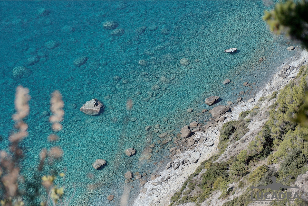
Clear water in a small cove between Levanto and Mesco Cape along the Cinque Terre coast

Photo taken with a Canon EOS M100 camera and a Tamron 16-300 lens.

And here is the video from the same spot:

Video shot with a Canon EOS M100 camera and a Tamron 16-300 lens.

Where the spot is located (more or less):

Add one  comment to this article or read  here what other visitors have written.
 
Adv
 
Disclamer

The rights on images, videos, choruses, text and all other material on the LUCADEA.com website are governed as per  Copyright page.


This page has been viewed 1 times today.
This month it has been viewed 1 times.
In total it has been viewed 1 times.
 

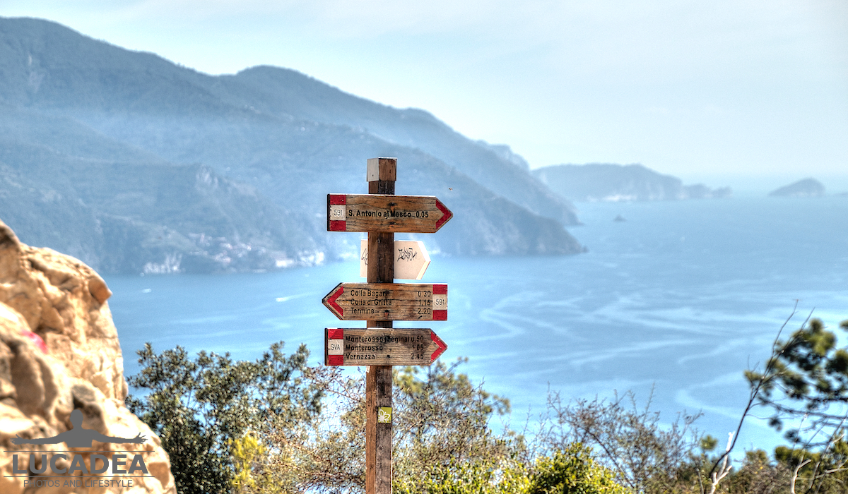
Signs along the Punta Mesco trail

Cartelli sul sentiero di Punta Mesco tra Levanto e Monterosso, lungo uno dei percorsi delle Cinque Terre

Signs along the Punta Mesco trail.
While walking the trail between Levanto and Monterosso al Mare, I stopped in front of these signs, just a few minutes from the headland, along one of the most interesting sections of this Cinque Terre route. The Punta Mesco trail is one of the walks in eastern Liguria that is worth taking, especially because of the landscape revealed after crossing the promontory.
Punta Mesco lies between Levanto and Monterosso al Mare, in Liguria, Province of La Spezia, Italy, and is one of the most recognizable points along this part of the Cinque Terre coastline. The photograph does not show the most spectacular panorama of the walk, but rather a few simple trail signs that help hikers understand where they are. These are exactly the kind of details that often catch my attention when I photograph a path.
There are dozens of hiking trails in Liguria, but the route connecting Levanto and Monterosso has a character of its own. It crosses the Punta Mesco promontory and, after a fairly demanding walk because of its length and elevation changes, offers a completely different perspective of the coast. Once the headland has been crossed, the views towards the Cinque Terre begin to open up.
If you are looking for what to see while hiking in the Cinque Terre area, this route is interesting because there is no single destination that makes the whole experience worthwhile. The landscape changes gradually throughout the walk. Starting from Levanto, the trail climbs through vegetation, with glimpses of the sea appearing and disappearing between the trees and openings in the path. As Punta Mesco gets closer, the coastline becomes increasingly visible.
I took this photograph a few minutes from the headland, where the trail continues towards Monterosso. I wanted to capture the signs because they are part of the actual experience of walking here. They are not a monument and probably would not attract the attention of someone looking only for scenic views, but for a hiker they are a practical and familiar part of the journey.
What I remember most about this trail is the transition from the enclosed sections of the path to the open view of the sea and the Cinque Terre. The walk can certainly be tiring, especially when taken at a relaxed pace, but the landscape changes the feeling completely once the view opens up. This is one of those occasions when the final panorama becomes more meaningful because of everything experienced along the way.
There is also a small historical curiosity connected with Punta Mesco. The remains of the ancient hermitage of Sant’Antonio del Mesco can be found on the promontory. The ruins are a reminder that this landscape, now crossed mainly by hikers, was also inhabited and visited centuries ago, adding a historical layer to a coastline that is otherwise dominated by nature.
I took this photograph with my camera during the walk, without trying to create a particularly elaborate composition. I simply wanted to preserve a moment from the route, almost like a visual note of the road I had already covered. The signs, placed within the trail itself, quietly suggest that the walk towards Monterosso is still continuing.
The connection between Levanto and Monterosso is also a way of experiencing the Cinque Terre differently from the classic train journey. It is not necessarily the right choice for everyone, since the distance and elevation changes require a reasonable level of preparation, but for anyone who enjoys walking it provides a slower and more gradual way of entering the landscape.
After crossing Punta Mesco, the reward is mainly visual. The Cinque Terre begin to appear from a perspective that is completely different from the one experienced from the sea or railway. For me, that change is the most interesting part of the walk and what makes the route particularly memorable.
On my photoblog I have already shared several photographs from eastern Liguria, including trails and villages along the coast. This photograph of the signs at Punta Mesco naturally belongs to that wider story and almost anticipates the more panoramic images that can be taken further along the route.
Looking at the photograph again, I like the idea that these signs mark a small pause before the landscape changes. The path continues from there, but the views ahead make it much easier to understand exactly where you are.

Have you ever walked from Levanto to Monterosso through Punta Mesco? Add a comment or go to the bottom of the site to read what other visitors have written.

Trail signs at Punta Mesco between Levanto and Monterosso, along a Cinque Terre hiking route

Photo taken with Canon EOS M100 and lens Tamron 16-300.

Where Punta Mesco is located:

Add one  comment to this article or read  here what other visitors have written.
 
Adv
 
Disclamer

The rights on images, videos, choruses, text and all other material on the LUCADEA.com website are governed as per  Copyright page.

This page has been viewed 1 times today.
This month it has been viewed 1 times.
In total it has been viewed 1 times.
 

The Trail to Montallegro Sanctuary

Sentiero del Santuario di Montallegro sulle alture di Rapallo, tra vegetazione e tratti in pietra verso la città

The Trail to Montallegro Sanctuary.
Among the hiking trails I have started discovering since I became interested in trekking, this route has stayed with me in a particular way, mainly because it combines climbs, woodland, changing scenery and a few genuinely demanding sections. If you are looking for places to hike in the Tigullio area, the trail to Montallegro Sanctuary is one of the routes worth knowing.
Over the past few weeks, like many other people, I have become increasingly interested in trekking. One of my advantages is living in this part of Liguria, where there are countless trails to explore without having to travel far. A short distance from the coastal towns, the landscape changes completely and the paths begin climbing into the hills.
Last week I went with a few friends to tackle a route starting in Chiavari, passing by the Sanctuary of Our Lady of Grace, climbing to Montallegro Sanctuary and then continuing downhill towards Rapallo. The whole route was around fifteen kilometres, so it was certainly more than a casual walk. Some sections, particularly near the beginning, were quite tough.
I took this photograph myself while we were walking. Among the pictures I made that day, I wanted to keep some simple views of the trail rather than looking only for spectacular panoramas. The path itself was part of the experience, and walking along it made me notice how quickly the surroundings could change.
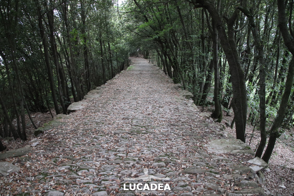
The photograph shows one of the sections leading from Montallegro Sanctuary towards Rapallo, which I walked downhill. After the harder climbs, this part felt like an opportunity to slow down and pay more attention to the landscape around me, although walking downhill does not necessarily mean that a trail becomes easy.
Montallegro Sanctuary stands on the hills above Rapallo, in Liguria, in the Metropolitan City of Genoa, Italy, at an altitude of roughly six hundred metres. Its position is one of the reasons I find the surrounding trails so interesting: within a relatively short distance, you can move from the coast into a landscape that feels much more mountainous.
There is also a small historical curiosity connected with the sanctuary. According to local tradition, in 1557 the Virgin Mary appeared to a farmer named Giovanni Chichizola on Mount Montallegro, leading to the development of the sanctuary and the religious tradition associated with the site. It remains an important part of the cultural identity of the area.
What I enjoyed most, however, was the route as a whole. Starting in Chiavari, passing the Sanctuary of Our Lady of Grace, climbing towards Montallegro and then descending to Rapallo means crossing several different environments while remaining within the same landscape of the Tigullio.
The first section was, as I mentioned, the part that made me work hardest. Some stretches require a steady pace and a little concentration, especially when you are planning to complete the entire route. Once we reached the higher sections, though, the effort began to feel worthwhile because of the variety of the trail.
It was also an interesting experience from a photographic point of view. When I go trekking, I cannot stop every few minutes to photograph everything that catches my eye. At the same time, some views are impossible to ignore. When that happens, I try to stop long enough to take a photograph and then continue walking with the others.
That is very different from going out specifically with photography in mind. On a hiking day, the trail determines the rhythm and the photographs become almost a natural consequence of the walk. Perhaps that is why these images feel so closely connected to the memory of the day.
I have already shared several photographs of Rapallo and the Tigullio area on the blog, from the Music Pavilion on the seafront to the old caruggi in the center. This photograph offers a completely different perspective: instead of the town and its buildings, it shows the landscape surrounding Rapallo and the trails that connect the coast with the hills above it.
The complete route we walked was around fifteen kilometres, and for anyone not accustomed to trails with elevation gain, I would consider it something that deserves a little preparation. It is not a route I would describe as a casual stroll, but that is also part of what makes it satisfying.
I have included only a couple of photographs from that day. One shows the road descending from Montallegro towards Rapallo, while the other captures one of the many trail sections we crossed. They are simple images, but for me they work as a small photographic diary of this new interest in trekking.
It is funny to think that even though I know the Tigullio area fairly well, there are still so many trails I had never walked. Perhaps that is the best part of it: change direction, leave the main road behind for a few hours and suddenly discover another side of a familiar landscape.

Have you ever walked the trail from Montallegro Sanctuary down towards Rapallo? Add a comment or go to the bottom of the site to read what other visitors have written.

Trail from Montallegro Sanctuary above Rapallo, with a stone path winding through vegetation towards the coast

Trail from Montallegro Sanctuary above Rapallo, with a stone path winding through vegetation towards the coast

Photos taken with a Canon EOS M100 camera and Tamron 16-300 lens.

If you would like to see all the photos taken along the trail, click here:
foto gallery

If you would like to know more about this trail, I invite you to visit the website: wikiloc.com.

A small alley in Bonassola by the sea

Vicoletto di Bonassola in Liguria con case colorate e scorcio del borgo sul mare

A small alley in Bonassola by the sea.
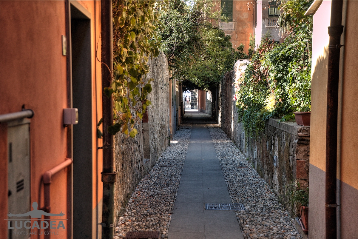
Walking through the small Ligurian village of Bonassola, I found this quiet corner made of colourful walls, narrow passages and the typical atmosphere of the villages along the Ligurian coast. A simple photograph, but one that captures the character of a place lived at a slower pace.
I took this image during a summer day spent walking between the sea and the mountains. After exploring some of the paths around the area and enjoying the landscape from different viewpoints, I also stopped to photograph the village itself, where the smallest details often become the most interesting subjects.
The narrow alleys of Bonassola are one of the things worth discovering while walking through the village. They may not have the importance of famous monuments or large squares, but they preserve all those details that make a Ligurian town recognizable: colourful facades, shutters, small streets following the shape of the land and unexpected views opening towards the sea.
Bonassola is located in Liguria, Italy, in the province of La Spezia, and is a small coastal village known for its beach, peaceful atmosphere and scenic paths connecting the coast with the surrounding hills. This combination of sea and hiking routes makes it a place worth seeing for those who enjoy walking and discovering quieter destinations.
I took this photograph because it represents the kind of image I often look for during my walks: not necessarily the most famous attraction, but a small corner that can bring back the feeling of being there at that exact moment.
A small curiosity about Bonassola is that the village is part of an area where, in the past, connections between coastal towns relied mainly on walking paths and mule tracks. Many of these routes are now appreciated by hikers who want to explore the landscape more slowly.
Just like other Ligurian villages I have photographed, from the alleys of Moneglia to the narrow streets of Sestri Levante, these small passages often reveal the true identity of a place.
Sometimes a simple alley is enough to preserve the memory of a beautiful day spent walking without a hurry.

Have you ever discovered a small corner of a village that became one of your favourite memories? Add a comment or go to the bottom of the site to read what other visitors have written.

Small alley in Bonassola, Liguria with colourful houses and a view of the coastal village

Photo taken with a Canon EOS M100 camera and Tamron 16-300 lens.

Click here to see all the photos of the village:
foto gallery

Where the small village is located:

According to some historical sources, the village’s name derives from *Bulnetia* or *Bodetia*, names that appear in early medieval writings. Other sources, considered more reliable, point instead to the ancient term *Vallis Bonazolae*, referring to the coastal area situated between the present-day towns of Framura to the west and Levanto to the east.
Read more on Wikipedia

The bridges of Valle del Fico in Sestri Levante

Ponti della Valle del Fico a Sestri Levante lungo il sentiero storico verso le Rocche di Sant’Anna

The bridges of Valle del Fico in Sestri Levante.
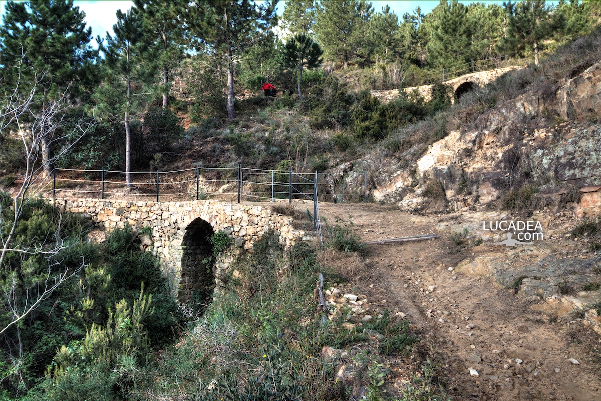
While walking towards the Rocche di Sant’Anna in Sestri Levante, I discovered one of the most interesting and lesser-known corners of the area: the ancient bridges of Valle del Fico, part of a route where nature, history and old paths come together. In this photograph, some of these small stone structures can still be seen along the trail.
This image comes from my desire to show a different side of Sestri Levante, away from the famous seaside views and the historic centre. Although the town is best known for its bays and coastal scenery, a short distance away it is still possible to find paths where the past survives through old stones and forgotten routes.
To reach the Rocche di Sant’Anna, where the remains of the ancient church stand above the road and railway tunnels connecting Sestri Levante and Lavagna, there are two possible routes. One is a more direct and steep path carved into the rock, while the other follows an older and gentler route through Valle del Fico, crossing these five bridges.
The bridges of Valle del Fico are usually considered medieval structures, although some theories suggest they may have even older origins, possibly dating back to Roman times. Their presence shows the importance of these paths before modern roads were built. Recently restored, they allow visitors to rediscover a historic route with a unique character.
I wanted to photograph these bridges because they represent a Liguria made of hidden passages, ancient paths and simple structures that were essential for everyday life in the past. They are not large monuments, but this is exactly what makes them fascinating: they preserve a direct connection with the history of the landscape.
One interesting detail is that these bridges were built to overcome small streams and changes in elevation along an old walking route. Their construction shows how even simple infrastructures were carefully designed and built to survive through centuries.
On my blog I often share trails, villages and lesser-known places in Liguria because I believe these areas reveal the most authentic side of the region. Like other walks I have photographed, the route through Valle del Fico towards Rocche di Sant’Anna combines a pleasant hike with the discovery of local history.
If you are looking for things to see in Sestri Levante beyond the beaches and the town centre, Valle del Fico is a fascinating path to explore, especially for those who enjoy finding historical traces while walking.

Have you ever walked along this old trail with the bridges of Valle del Fico? Add a comment or go to the bottom of the site to read what other visitors have written.

Bridges of Valle del Fico in Sestri Levante on the historic trail to Rocche di Sant’Anna

Photo taken with a Canon EOS M100 camera and Canon EF-S 10-18 lens.

I have several photos taken along the trail that climbs to Rocche di Sant’Anna via the Fico Valley; click here to view them:

And here are a couple of videos:


Videos recorded with Gopro Hero 10 Black.

Sestri Levante from the Punta Manara trail

Vista di Sestri Levante dal sentiero di Punta Manara con Baia del Silenzio e penisola ligure

Sestri Levante from the Punta Manara trail.
Walking along the Punta Manara trail in Sestri Levante, one of the most loved paths in the Tigullio area, I stopped right where the view suddenly opens up, revealing one of the most iconic sights among the things to see in Sestri Levante. From here, the Bay of Silence and the narrow peninsula appear in perfect balance, making this section of the trail truly unforgettable.
My pace slowed down without even noticing. It wasn’t just the climb, but that natural urge to pause and take in the scene. This spot along the Punta Manara trail in Sestri Levante is the kind of place that stays with you, even if you’ve been there before. Each time feels slightly different: the light, the colors, the sea.
I was in Sestri Levante, Liguria, Italy, and from up there the town looked almost sheltered, shaped by the sea around it. The Bay of Silence, with its gentle curve, stood in contrast with the more open side facing Riva Trigoso. I had written about this place before from the beach and from the town itself, but from here it feels like a completely new perspective.
If you are visiting Sestri Levante and wondering what to see beyond the beaches, this trail is definitely worth your time. It’s not just about the destination, but about the way the landscape slowly reveals itself as you walk.
An interesting detail is that the name “Bay of Silence” is relatively modern, chosen to reflect the calm and intimate atmosphere that you can feel both from above and at sea level.
The trail itself is considered one of the most accessible and scenic in the area, which makes it popular but still enjoyable if you find the right moment. I stayed there for a while before continuing toward Riva Trigoso, trying to hold onto that quiet balance between land and sea.

Have you ever stopped halfway through a hike just because the view was too good to leave behind? Add a comment or go to the bottom of the site to read what other visitors have written.

Vista di Sestri Levante dal sentiero di Punta Manara con Baia del Silenzio e penisola ligure

Photo taken with Canon EOS M100 and lens Tamron 16-300.

To see the data on the path I invite you to the site: wikiloc.com.

Sestri Levante from the Punta Manara trail – Sestri Levante vu depuis le sentier de Punta Manara – Sestri Levante visto desde el sendero de Punta Manara – Sestri Levante visto do trilho de Punta Manara – Sestri Levante vom Wanderweg Punta Manara – Sestri Levante nhìn từ đường mòn Punta Manara – 从蓬塔马纳拉步道看塞斯特里莱万特 – プンタマナラの小道から見たセストリ・レヴァンテ

The text of this post was written with the help of ChatGPT, a language model from OpenAI.

The spectacular view from the top of Mount Zatta

La spettacolare vista dalla cima del Monte Zatta

The spectacular view from the top of Mount Zatta.
Some time ago, I walked along the circular trail of Mount Zatta and reached one of those viewpoints that remain in your memory long after the walk is over. The view from Mount Zatta in Liguria is not only about the landscape itself, but also about the path that leads there and the quiet moments experienced along the way.
I remember taking this hike with the desire to slow down and pay attention to the details around me. The trail crossed a natural environment where every section had something different to reveal, gradually leading toward the summit of Mount Zatta, where the landscape finally opened and showed the full beauty of the surrounding mountains.
Mount Zatta is located between Liguria and Emilia-Romagna, in Italy, within the Ligurian Apennines area, and it is an interesting destination for those who enjoy walking through nature. From the summit, when conditions allow, the view extends across the mountain landscape connecting the inland areas of Liguria with the wider Apennine region.
What impressed me most was not only reaching the top, but the entire experience of getting there. Every turn of the trail seemed to slowly prepare for that final moment when the effort of walking becomes the satisfaction of arriving. It reminded me of other nature stories I have shared on the site, where the journey itself becomes just as important as the final destination.
A small curiosity about Mount Zatta is its beautiful beech forests, among the most characteristic woodland environments of the northern Apennines. These forests accompany parts of the trails and create a changing atmosphere throughout the seasons.
Photographing the summit of Mount Zatta meant keeping more than just an image. It preserved the memory of a day spent walking, observing, and reaching a place that rewarded every step. Some landscapes do not need anything artificial to be impressive: a mountain, a trail, and enough time to experience them can be more than enough.

Have you ever followed a trail that rewarded you with a view you could never forget? Add a comment or go to the bottom of the site to read what other visitors have written.

La spettacolare vista dalla cima del Monte Zatta

La spettacolare vista dalla cima del Monte Zatta

Photos taken with GoPro Hero 10 black.

I took several photos along the Monte Zatta trail, and if you’d like to see them, go to this page:

For a detailed view of the trail I hiked, I invite you to visit wikiloc.com.

Here’s where the summit is:

The summit of the Monte Zatta massif consists of a long, undulating ridge, crossed by an easy ridge trail. On the outer edges of this ridge are Monte Zatta di Ponente (1,355 m) and Monte Prato Pinello (1,390 m). Between the two ends rises the main peak, Monte Zatta di Levante (1,404 m). The southern slope is steep and rocky, while the northern slope, towards the Bocco Pass, has a gentler slope and is covered in a large beech forest.
Continue and learn more at Wikipedia

The spectacular view from the top of Mount Zatta – La vue spectaculaire depuis le sommet du Monte Zatta – La espectacular vista desde la cima del Monte Zatta – A vista espetacular do topo do Monte Zatta – Der spektakuläre Blick vom Gipfel des Monte Zatta – Cảnh đẹp ngoạn mục từ đỉnh núi Zatta – 扎塔山顶的壮丽景色 – モンテ・ザッタ山頂からの壮大な眺め

The text of this post was written with the help of ChatGPT, a language model from OpenAI.

Arrival in Manarola

L'arrivo a Manarola alle Cinque Terre

Arrival in Manarola.
The path down to Manarola reveals itself gradually after the long trail coming from Volastra, and Arrival in Manarola becomes more a feeling than a simple destination. Arrival in Manarola along the vineyards of the Cinque Terre starts to take shape even before the village is fully visible, when the landscape becomes steeper and the sea seems to approach with every step.
I am in Manarola, in the Cinque Terre, Liguria, Italy, after walking the demanding trail that connects Volastra to the village. The climb and countless steps have already tested the body, but the descent changes everything. The path splits into different options, and one of them cuts sharply through steep vineyards that hang above the village.
Here, Arrival in Manarola becomes a slow reveal: first the terraced fields, then the dry stone walls, and finally the colorful houses appearing between curves of the path. Each step downward reshapes the perspective and reduces the distance to the sea until it almost disappears.
Walking here also means understanding how much of this landscape is human-made. The vineyards carved into extreme slopes reflect centuries of constant labor, and the path itself feels like a connection rather than a separation. In this sense, Arrival in Manarola along the Cinque Terre trails is not just arrival, but transition.
A small but important detail: the terraced landscapes of the Cinque Terre are supported by thousands of kilometers of dry stone walls, a traditional construction technique recognized by UNESCO as part of intangible cultural heritage.
In other photographic stories about Liguria on this site, I have often noted how these paths are not just links between villages but immersive experiences between land and sea.
When the village finally comes into view, Arrival in Manarola feels less like reaching a point and more like entering a living landscape.

Have you ever experienced a descent that felt more intense than the climb? Add a comment or go to the bottom of the site to read what other visitors have written.

L'arrivo a Manarola alle Cinque Terre

Photo taken with Canon EOS M100 camera and Tamron 16-300 lens.

Manarola, like the other Cinque Terre, is squeezed between the Ligurian Sea and the steep mountain range that branches off from the Apennines near Monte Zatta and slopes southeast, forming a watershed between the Vara Valley and the coastal area. The village lies at the end of the Groppo River valley.
Continue reading and learn more at Wikipedia

Arrivo a Manarola alle Cinque Terre – L’arrivée à Manarola dans les Cinque Terre – Llegada a Manarola a las Cinque Terre – Chegada a Manarola nas Cinque Terre – Ankunft in Manarola in den Cinque Terre – Đến Manarola ở Cinque Terre – 到达五渔村的马纳罗拉 – チンクエテッレのマナローラ到着

The text of this post was written with the help of ChatGPT, a language model from OpenAI.

Hiking from Corniglia to Manarola through vineyards

Trekking da Corniglia a Manarola tra i vigneti delle Cinque Terre con sentiero ripido e vista panoramica sulla costa ligure

Hiking from Corniglia to Manarola through vineyards.
The hiking from Corniglia to Manarola through vineyards in the Cinque Terre is one of those routes that stays with you long after you finish it, mainly because of the constant contrast between effort and scenery. Thinking about the hiking from Corniglia to Manarola through vineyards immediately brings back the steep paths and the way the landscape suddenly opens into breathtaking views.
I was walking in the area of the Cinque Terre in Liguria, Italy, one of the most iconic coastal regions in the country, where ancient paths connect cliffside villages and terraced vineyards. In this setting, the hiking from Corniglia to Manarola through vineyards becomes both a physical challenge and a deeply rewarding experience.
The section passing through Volastra is particularly demanding, with continuous climbs and uneven terrain that test even experienced hikers. But every time I stopped, the view made the effort disappear for a moment. Seeing Manarola suddenly appear, surrounded by vineyards carved into the hills, is one of those unforgettable rewards that define this hike.
In another post on my photoblog I described calmer coastal walks like the Bay of Silence in Sestri Levante, but this experience is completely different: more rugged, more physical, and far more immersive.
A small curiosity: the terraced landscape of the Cinque Terre is entirely man-made, built over centuries by hand to create agricultural land on extremely steep slopes.

Have you ever done a difficult hike that rewarded you with an incredible view at the end? Add a comment or go to the bottom of the site to read what other visitors have written.

Trekking da Corniglia a Manarola tra i vigneti delle Cinque Terre con sentiero ripido e vista panoramica sulla costa ligure

Photo taken with Canon EOS M100 and Tamron 16-300 lens.

Click here to see some photos I’ve taken in the past:
foto gallery

Here’s where Manarola is located:

Corniglia to Manarola hike – Randonnée de Corniglia à Manarola – Senderismo de Corniglia a Manarola – Caminhada de Corniglia a Manarola – Wanderung von Corniglia nach Manarola – Trekking Corniglia đến Manarola – 从科尔尼利亚到马纳罗拉徒步 – コルニリアからマナローラへのトレッキング

The text of this post was written with the help of ChatGPT, a language model from OpenAI.

Tavarone, a small village in Ligurian mountains

Tavarone visto dalla chiesa di San Bartolomeo, con le case del borgo e le montagne dell'entroterra ligure

Tavarone, a small village in Ligurian mountains.
During my visit, I stopped near the church of San Bartolomeo Apostolo and looked across the village, where the houses follow the hillside and the surrounding mountains create a very different landscape from the Liguria most people usually picture. When I think about what to see in Tavarone, this view is still one of the images I remember most clearly.
I took this photograph myself during my visit, choosing this particular viewpoint because it showed the village and its surroundings in a simple and natural way. I was not looking for a complicated composition or a famous landmark. I wanted to capture Tavarone as I actually saw it, with the houses, the church and the green mountain landscape forming one scene.
Tavarone is a hamlet of Maissana, in the Province of La Spezia, Liguria, Italy, at roughly 600 metres above sea level. It belongs to the inland part of Liguria, where the landscape changes quickly after leaving the coast. Roads climb through wooded hills and valleys, leading to small villages that feel quite different from the seaside towns of the Riviera.
That transition from the coast to the mountains was one of the things that interested me most. Tavarone does not rely on a monumental square or a famous building to make an impression. Its character comes from the relationship between the village and the landscape around it. From this viewpoint, the position of the houses on the mountainside becomes immediately clear.
The church of San Bartolomeo Apostolo is one of the main landmarks visible in the photograph. The present church dates from the seventeenth century and contains a wooden choir dated 1715. It is only a small historical detail, but I think details like this are useful when looking at a photograph of a small village because they remind us that the apparently simple landscape has a much older story behind it.
There is also an interesting explanation connected with the name Tavarone. According to information published by the Municipality of Maissana, the name may have originated from an old tavern with accommodation that once offered shelter to travellers using a route between the coast and the inland valleys. The name may then have developed from Taverna to Tavernone and eventually Tavarone. I like this kind of small curiosity because it connects the identity of the village with its position along old mountain routes.
If you are looking for what to see in Tavarone, the village centre and the church are a natural starting point, but the surrounding landscape is just as important. The area around Tavarone includes woods, mountain ridges and several walking routes, making it interesting for anyone who wants to explore this quieter side of Liguria.
Among the local routes is the Anello del Benessere, a network of paths connecting different parts of the Maissana area. The routes can be explored on foot, by mountain bike or on horseback and provide a way to move away from the village and into the surrounding countryside.
The nearby Valle Lagorara is another interesting destination, particularly because of its geological features and the traces of ancient stone extraction. The mountains around the area, including Monte Porcile and Monte Alpe, also offer opportunities to continue exploring the inland landscape.
Tavarone is also in an interesting position for anyone travelling from the coast. Coming from Sestri Levante and the Tigullio, the change is quite noticeable as the road climbs inland. In a relatively short distance, the seaside landscape gives way to mountain roads, woods and small villages in the Province of La Spezia.
If you are visiting the area, reaching Tavarone means leaving the main coastal route and travelling inland. That small change of direction is part of what makes the visit interesting. For current information about roads, local events and activities, the official Municipality of Maissana website and the Tavarone Pro Loco website are useful references.
Looking back at the photograph, what I still like most is its simplicity. There is no imposing monument dominating the frame and no need for a particularly elaborate composition. The village simply sits on the mountainside, and from the right viewpoint its character becomes visible.
This is also the kind of photograph I like to keep over time. When I photograph a small village, I am not only interested in how it looks on that particular day. I also know that a photograph can become a record of a place as I saw it at a certain moment. Houses change, roads are modified and the way people use a village can evolve, while the image remains as a small personal document.
Tavarone gave me precisely this impression: a place that rewards a slower look rather than a quick visit. Its interest is in its position, its mountain surroundings and the way the village fits naturally into the landscape.
On my photoblog I have also photographed other places in inland Liguria and around the Tigullio. I like connecting these different stories because together they show a side of Liguria that is easy to miss when travelling only between the better-known coastal towns.
This photograph of Tavarone came from that same curiosity. It is a picture of a place that may not immediately appear among the most famous things to see in Liguria, but once you stop and look at the village from this viewpoint, it becomes easy to understand why the inland landscape deserves attention too.

Have you ever visited Tavarone, and is there a particular view or detail of the village that stayed with you? Add a comment or go to the bottom of the site to read what other visitors have written.

Tavarone seen from San Bartolomeo church, with the village houses and mountains of inland Liguria behind them

Photo taken with Canon EOS RP and Canon RF 24-50 lens.

To see all the photos I took in the village, click here:
foto gallery

Here’s where the village is located:

🏠
  • Italiano